Santorini, named by the Venetians in the 13th century, is a volcanic island in the Aegean Sea. Small in size, just 28 square miles, and home to only around 13,600 Greek citizens, it is known for its black volcanic sandy beaches and high-end style. Full of historic sites, empty beaches and clear, blue waters, it should be near the top of any Greek wish-list.
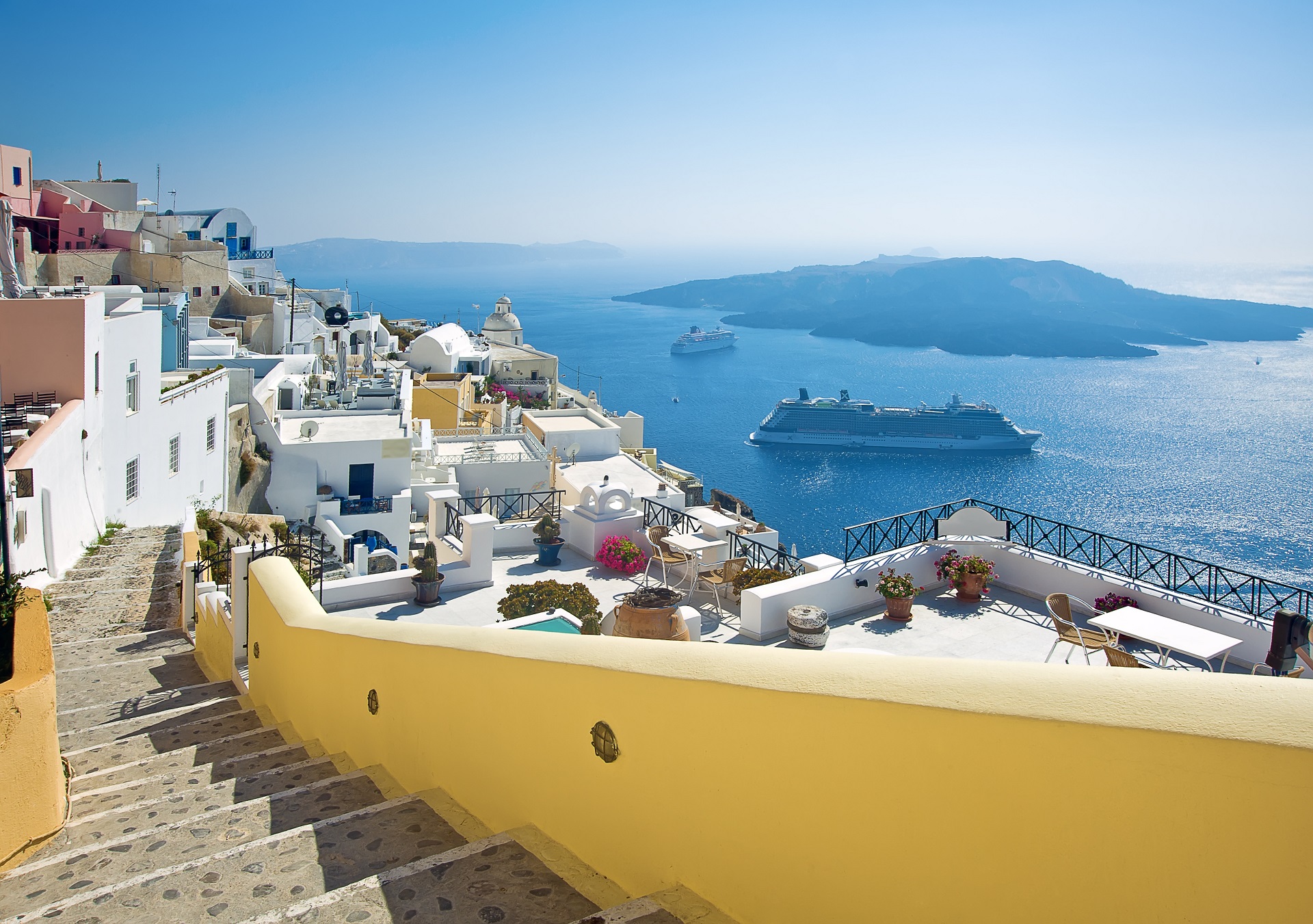
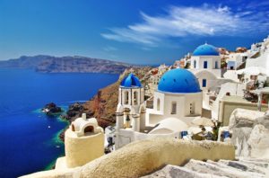
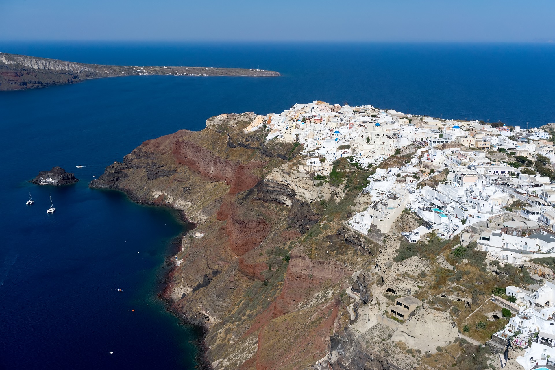
Santorini may well have conquered a corner of your imagination before you’ve even set eyes on it. With multicolored cliffs soaring over 300m from a sea-drowned caldera, it rests in the middle of the indigo Aegean, looking like a giant slab of layered cake. The island spoons the vast crater left by one of the most significant volcanic eruptions in history. Smaller islands curl around the fragmented western edge of the caldera, but it is the main island of Thira that will take your breath away with its snowdrift of white Cycladic houses lining the cliff tops and, in places, spilling like ice cornices down the terraced rock. When the sun sets, the reflection on the buildings and the glow of the orange and red in the cliffs can be truly spectacular.
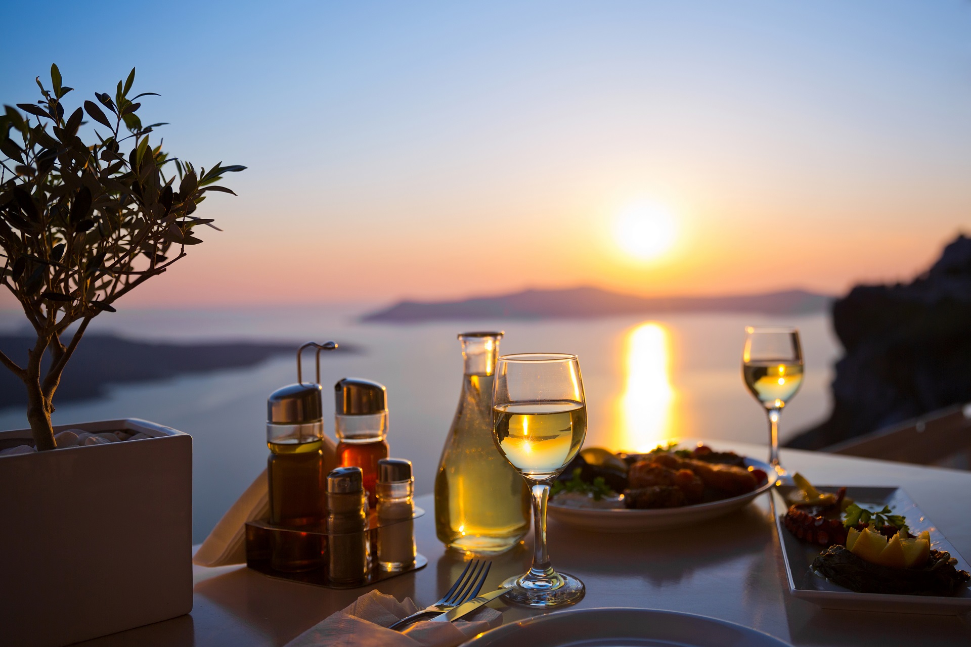
Santorini draws crowds during the whole time of the year, yet it wears its tourism well, and its offerings make it worth the visit. The island’s intrigue reaches deep into the past, with the fabulous Minoan site of Akrotiri and the picturesque traditional hilltop village of Oia. It also glides effortlessly into the future with accomplished artists, world-class wineries, a unique microbrewery, and some of the Cyclades most exceptional accommodation and dining experiences. The multicolored beaches are merely the icing on the cake.
The Island of Santorini – Thera
- Santorini is the southernmost island of Cyclades and is located between Ios and Anafi.
- It is 128 nautical miles away from the port of Piraeus and 63 nautical miles away from Crete.
- Its size is 76 square km, and the length of its shores is 69 km. The perimeter is approximately 36 nautical miles.
- Thera, Therassia, Aspronisi and the volcanoes (Palaia Kameni and Nea Kameni where the crater of the volcano exists) forming the cluster of islands which is called Santorini.
- It is included, together with Methana, Nisiros, and Milos, in the most active of volcanoes in Greece.
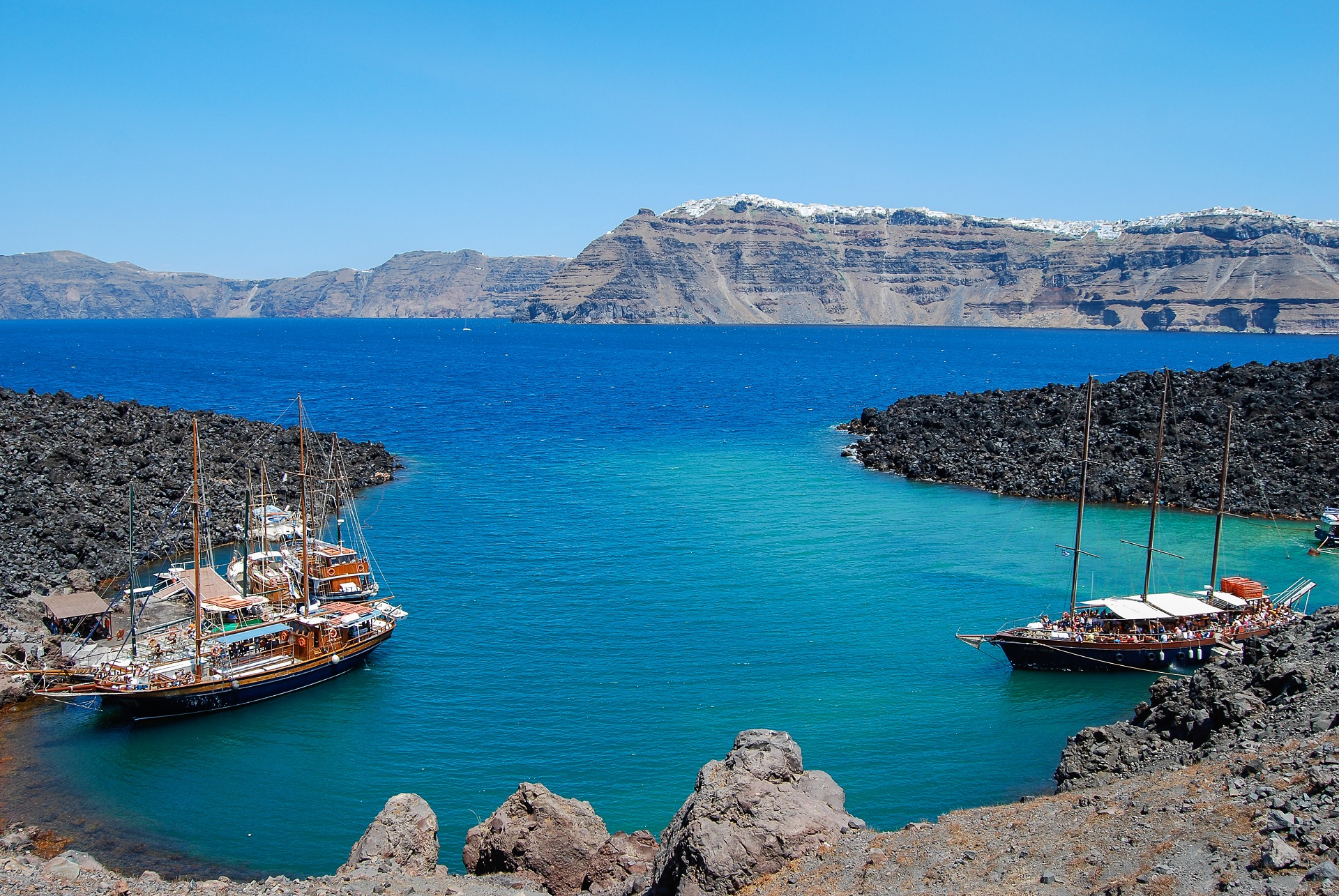
- Three main islands form a”ring” around the Caldera, the bay which was created when the central part of ancient Strongyli sank to the seabed. Its dimensions are 8×5 km, and its depth is as deep as 370 m.
- The enormous crater formed by the volcanic eruption of around 1600 BC, adds to its distinct atmosphere: settlements are built on the edge of the crater’s inner walls and not on the sea level, as in other islands. Also, Santorini is one of the few places worldwide where architectural complexes of underground rock-hewn houses still survive in the volcanic soil.
- The Caldera and the whole cluster of the Santorini islands have been characterized as an area of outstanding natural beauty.
- The name Thera is given after the legendary settler Theras of Sparta, who settled on the island and founded the homonymous town in Mesa Vouno approximately the 10th century B.C.
- The name Santorini was given in 1153 by the Venetians and is referred to Arab geographer Edrisi. It is a pronunciation of both words Santa and Irene (Saint Irene), taken after either from the name of the church in the valley of Therassia or from the name of the early Christian basilica in Perissa, which is not preserved.
- The main island, Thera, has a shape of a half moon and is located in the easternmost position of the cluster. The west side consists of the walls of the Caldera which preserve the picture of its geological history and illustrate the different phases of the volcanic activity.
- There are thirteen villages in Thera and three villages in Therassia.
- The capital of the island is Fira. The name derived from the corruption of the word Thera, which is the official one.
The Volcano
Volcanism on Santorini is due to the Hellenic Trench subduction zone southwest of Crete. The oceanic crust of the northern margin of the African Plate is being subducted under Greece and the Aegean Sea, which is thinned continental crust. The subduction compels the formation of the Hellenic arc, which includes Santorini and other volcanic centers, such as Methana, Milos, and Kos.
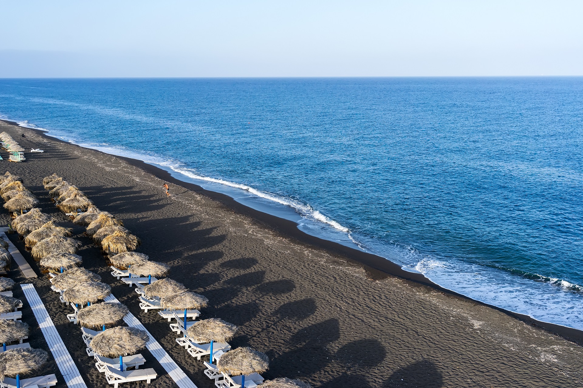
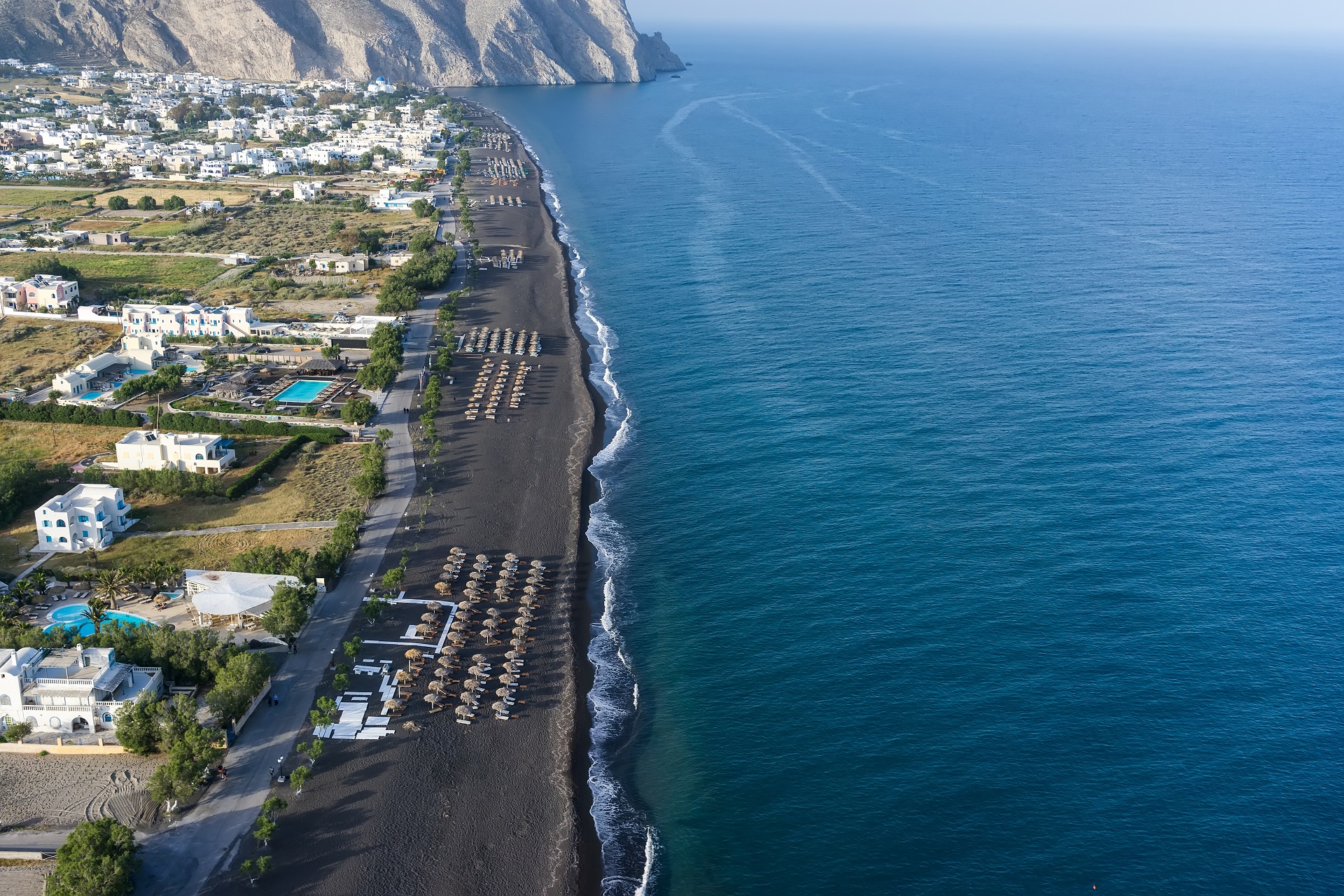
The island is the result of repeated sequences of shield volcano construction followed by caldera collapse. The inner coast around the caldera is a sheer precipice of more than 300 meters (980 ft) drop at its highest and exhibits the various layers of solidified lava on top of each other and the main towns perched on the crest. The ground then slopes outwards and downwards towards the outer perimeter, and the outer beaches are smooth and shallow. Beach sand color depends on which geological layer is exposed; there are beaches with sand or pebbles made of solidified lava of various colors: such as the Red Beach, the Black Beach and the White Beach. The water at the darker colored beaches is significantly warmer because the lava acts as a heat absorber.
The area of Santorini incorporates a group of islands created by volcanoes, spanning across Thera, Thirasia, Aspronisi, Palea, and Nea Kameni.
Santorini has erupted many times, with varying degrees of explosivity. There have been at least twelve massive explosive eruptions, of which at least four were caldera-forming. The most famous one is the Minoan eruption, detailed below. Eruptive products range from basalt all the way to rhyolite, and the rhyolitic products are associated with the most explosive eruptions.
The earliest eruptions, many of which were undersea, were on the Akrotiri Peninsula, and active between 650,000 and 550,000 years ago. These are geochemically distinct from the later volcanism, as they contain amphiboles.
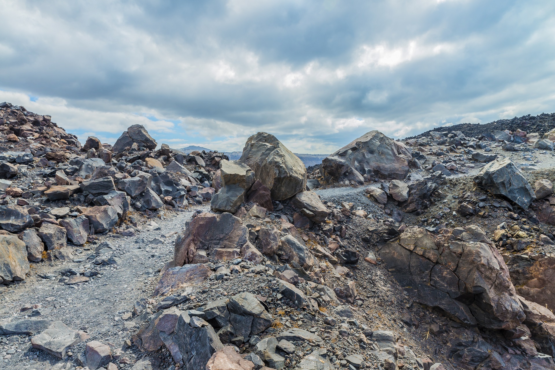
Over the past 360,000 years, there have been two major cycles, each culminating with two caldera-forming eruptions. The cycles end when the magma evolves to a rhyolitic composition, causing the most explosive eruptions. In between the caldera-forming eruptions are a series of sub-cycles. Lava flows and small explosive eruptions build up cones, which are thought to impede the flow of magma to the surface. This allows the formation of large magma chambers, in which the magma can evolve to more silicic compositions. Once this happens, a massive explosive eruption destroys the cone. The Kameni islands in the center of the lagoon are the most recent example of a cone built by this volcano, with much of them hidden beneath the water.
Volcanic craters and hot springs are present on both islands. Dormant Craters and active vents can be visited on Nea Kameni. Both volcanic isles are under scrutiny by satellite as well as underground systems. Even the minutest alteration is recorded to forecast any hint of reactivation.
Architecture
As part of the Aegean style, traditional Santorini architecture exhibits an unusual freedom of expression as it incorporates the particularities of the island into the structured environment. The peculiarity of the ground allows for the creation of subterranean buildings under cultivated fields. Buildings so closely connected to each other that you cannot tell where one property ends and where the other begins…
M. Danezis, 1939, “The Theraic Common Law in the 18th century”.
The essential factor in the creation of the built-up space on the island from the Middle Ages until the late 18th century had always been that of safety. Living under circumstances of turmoil and being exposed to pirate raids, the inhabitants were forced to an incessant defensive struggle. Therefore, architecture ought to have had a defensive character, that is to provide security above all.
More or less, it used to serve only essential needs. Far from setting off any stylistic elements, it derived from the particular manner of development and the structures themselves. This specific architectural morphology owes its existence to exclusively local factors: Social, financial, structural and geomorphological ones. Commercial sources were limited, homes were built by unskilled workers (usually the owners themselves). Dwellings were cut in the volcanic lava in an attempt to cover life’s needs in an improvised manner lacking any intention of differentiation.
As time passed, especially from the end of the 18th century onwards, survival demands had been overcome by certain population groups, and it was time for the architectural forms to serve other purposes. Lords and people well-to-do could lead a much more comfortable life, but they could do it only in a large, comfortable and richly decorated home.
Considering mansions, the architecture of the 18th and 19th centuries witnessed the artistic intervened of masters and reflected the models of a great art either indirect or applied imitation according to local singularities. They took advantage of the influences of western or post-renaissance models, not by imitating them but by readjusting them to a simplified regional variation that could make use of the structural factors of the place. Classicism and its various forms came to be applied rather late, towards the end of the 19th century, mainly to the mansions of the wealthy, the big churches and public buildings (Museum, schools, etc.).
Even in those buildings that imitated official architecture produced an extremely successful result. The co-existence of vernacular together with those of conventional architecture within the settlements produced a fascinating effect but also fulfilled the novel requirements of the Theran society and the human needs.
Main types of Settlements & houses
Village settlements fell into three categories:
- Linear (Fira, Oia, Therassia)
- Evolved fortified (Pyrgos, Emporeio, Akrotiri village)
- Rock-hewn (Vothonas, Foinikia, Karterados).
As far as their construction is concerned, buildings could be
- Rock-hewn (underground)
- Built
- Semi-built
Types of houses were distinguished in:
URBAN & RURAL HOUSES
In Santorini, the original type of residence was like the one found inside the Kastelia. The one-room houses were either stone-built or rock-hewn, usually two-story, due to limited space, and narrow-fronted. An external staircase led to the upper floor. The ground floor accommodated auxiliary spaces, such as stables and storage areas. The homes of the nobles inside the castles probably followed the same rationale, only on a larger scale. When settlements expanded beyond the defensive perimeters, auxiliary buildings were added to the main construction, adjacent or connected to it through the yard, where a significant part of daily activities took place. Urban houses maintained their irregular shapes.
Rural houses had a big yard and auxiliary buildings (an outdoor, usually cylindrical, brick oven, stables, etc.). They were located in the countryside or on the village outskirts. Most of them also had kanaves (wineries).
18TH AND 19TH CENTURY MANSIONS
A few homes from that time survive in all villages. Residential complexes can be found in neighborhoods such as Sideras in Oia, Frangomahalas in Fira, and at the center of Mesaria (see also The Unknown Santorini and Attractions sections). Their foreign influences – Renaissance or Neoclassical or both – are distinct, as their owners had various contacts abroad. They are very imposing, with symmetrical, monumental fronts.
FOLK ARCHITECTURE HOUSES
These were built by non-experts to cover housing needs; however, they turned out to be artistic works of unique aesthetics. They are the most numerous on the island, mainly characterized by plasticity and simplicity. An interesting fact is that they overlap; they also have domes of different shapes and sizes, and their outdoor spaces are irregularly shaped. Fronts have small openings, windows, and doors with lunettes. This type of house was an inspiration for architects of the early 20th century, such as Le Corbusier, Alvar Aalto, and others.
CRAFTSMEN ARCHITECTURE HOUSES
Built by craftsmen, they were bigger and more complex than the folk architecture houses. Most urban houses and churches are typical examples of this category.
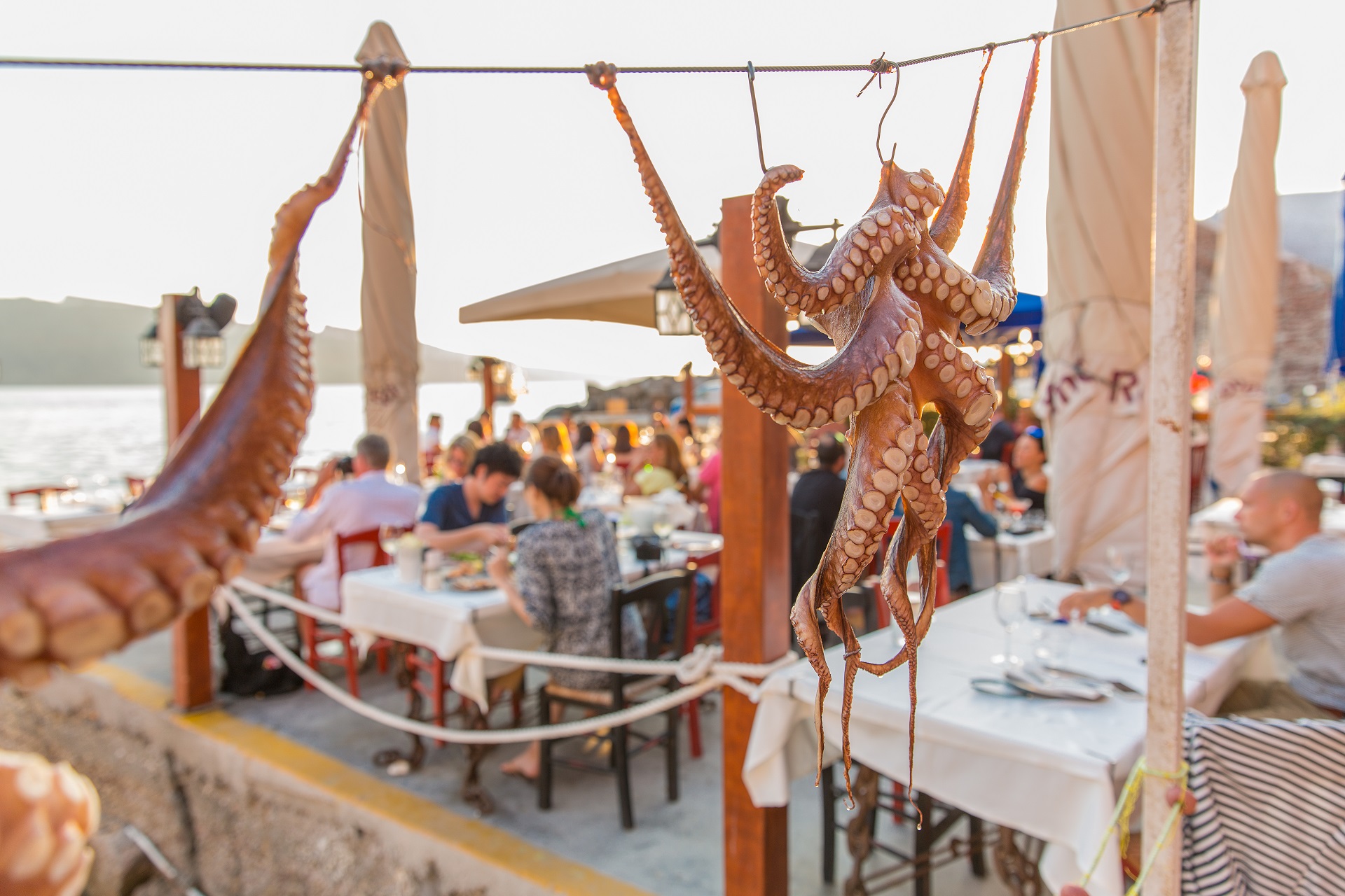
Cuisine
Local specialties you need to try:
- Brantada – A local Santorinian fish dish. Cod fillet coated in a mixture of flour, water, salt and sometimes beer, commonly served with garlic salad. The best place to try it is in some less touristic villages, like Exo Gonia.
- Koskosela (local Strapatsada)
- Santorinio Sfougato – A traditional Santorini dish. Ingredients: small zucchini, onions, extra virgin olive oil, flour, eggs, rosemary leaves or spearmint tea leaves or dill, xynomyzithra or other sour milk cheese or soft feta, Naxos sweet gruyère, salt, and fresh ground pepper, sweet peppers, sesame seeds.
- Tsounisti (Manestra)
- Fava – A local Santorini dish, originally made with the broad bean. Later on, the broad bean was replaced with an easier version; the yellow shelled lentil. Its name originates from the word “favus” which is the Latin word for broad beans.
- Melitinia (dessert) – Melitinia is cookies that are made for weddings, engagements, and festivals. They are made of unsalted mizithra cheese and yogurt, and they also have a beautiful smell of mastic. They can be found in the traditional bakeries of Santorini.
Wine industry
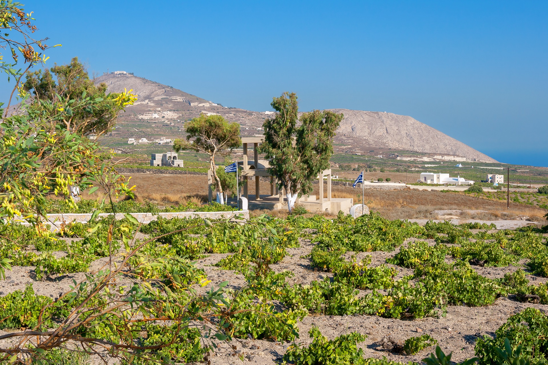
The island remains the home of a small, but flourishing, wine industry, based on the indigenous grape variety, Assyrtiko, with auxiliary cultivations of two other Aegean varietals, Athiri and Aidani. The vines are ancient and resistant to phylloxera (attributed by local winemakers to the well-drained volcanic soil and its chemistry), so the vines needed no replacement during the great phylloxera epidemic of the late 19th century. In their adaptation to their habitat, such vines are planted far apart, as their principal source of moisture is dew, and they often are trained in the shape of low-spiraling baskets, with the grapes hanging inside to protect them from the winds.
The viticultural pride of the island is the sweet and strong Vinsanto (Italian: “holy wine”), a dessert wine made from the best sun-dried Assyrtiko, Athiri, and Aidani grapes, and undergoing extended barrel aging (up to twenty or twenty-five years for the top cuvées). It matures to a sweet, dark amber-orange, an unctuous dessert wine that has achieved worldwide fame, possessing the standard Assyrtiko aromas of citrus and minerals, layered with overtones of nuts, raisins, figs, honey, and tea.
White wines from the island are extra dry with a strong, citrus scent and mineral and iodide salt aromas contributed by the ashy volcanic soil, whereas barrel aging gives to some of the white wines a slight frankincense aroma, much like Vinsanto. It is not easy to be a winegrower in Santorini; the hot and dry conditions give the soil a very low productivity. The yield per acre is only 10 to 20% of the yields that are common in France or California. The island’s wines are standardized and protected by the “Vinsanto” and “Santorini” OPAP designations of origin.
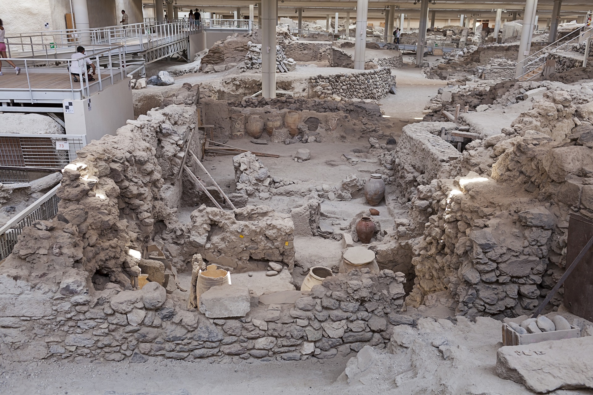
Minoan Akrotiri
The most prominent archaeological site in Santorini -and one of the most important archaeological sites in the Aegean– is Akrotiri and the findings of the excavations that began in 1967.
Akrotiri (Promontory) is located at the southwestern tip of the island, 15 km from Fira. It is a real promontory, with sheer cliff shores stretching three miles west of the southernmost part of Santorini.
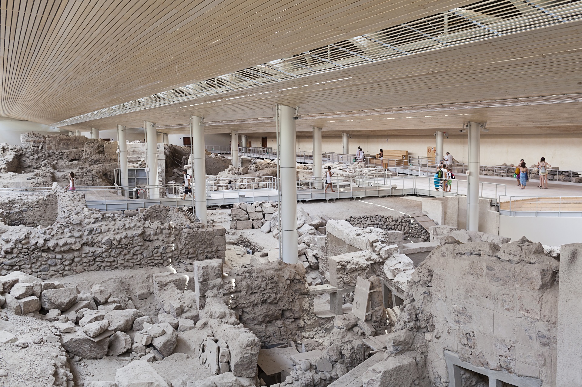
After several years, the archaeological site re-opened for the visitors since April 2012, after the new roof was in place.
The big excavation
First signs of habitation in Akrotiri date back to the Late Neolithic Period (at least from the 4th millennium BC). By the Early Bronze Age (3rd millennium BC), there was a settlement in Akrotiri that was expanded in the Middle and Late Bronze Age (20th-17th centuries BC) becoming one of the main urban centers of the Aegean.
Covering about 50 acres, the settlement had a very well-planned infrastructure and an elaborate sewage system. Imported products found inside the buildings prove that Akrotiri was well developed, held strong ties with Minoan Crete and conducted business with the Greek mainland, the Dodecanese, Cyprus, Syria, and Egypt.
The growth of the town ended abruptly at the end of the 17th century BC, when its inhabitants left due to powerful seismic foreshocks. Then, the volcano erupted, and volcanic material covered the town and the rest of the island, preserving the buildings and their contents to this day.
Professor Spyros Marinatos began systematic excavations in Akrotiri, in 1967. He had decided to excavate there to prove an old theory of his, i.e., that the eruption of the volcano caused the collapse of the Minoan civilization in Crete (see also Attractions-Volcano).
After Marinatos had died, in 1974, excavations continued under the direction of Professor Christos Doumas.
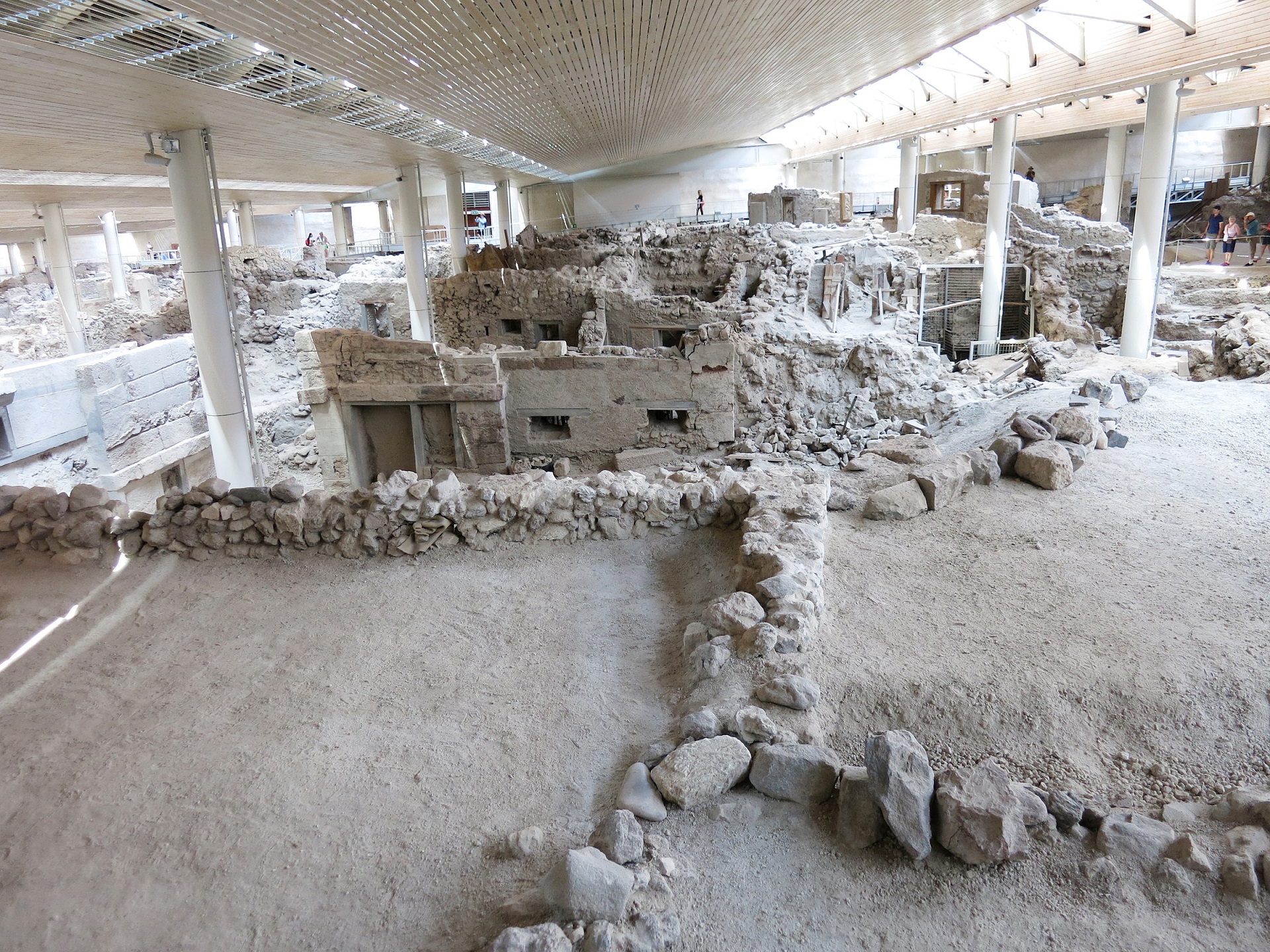
The Monuments
Xeste 3: A big, at least two-storied, building with 14 rooms on each floor. Many of them are connected with pier-and-door partitions (polythyra) and decorated with frescoes, while there is a “Lustral Basin” in one of them. The most impressive frescoes are the Crocus Collectors, depicting three women in a field of crocus clusters and an altar, as well as the Altar, which depicts women collecting crocus and offering them to a sitting deity, surrounded by an ape and a Griffin.
Section Β: It probably includes two separate buildings attached to each other. The frescoes of the Antelopes and the Boxers originated from the floor of the western building. The eastern building is the origin of the fresco of the Apes, a composition with monkeys climbing on rocks at the banks of a river.
The West House: A relatively small, but well-organized edifice. On the ground floor, there are food storage areas, workshops, a kitchen, and a mill facility. The first floor has a spacious room where looms, a food, and utensils storage area, a toilet and two consecutive walls with frescoes were located. Of these, the one is decorated with the two frescoes of the Fishermen, the fresco of the Priestess and the famous miniature frieze of the Fleet that runs its four walls. The frieze depicts a fleet visiting coastal cities, the last of which identifies with Akrotiri itself. The other space is decorated with the eight frescoes of the Ship Cabins.
Building Complex D: It consists of four buildings. A room of the east edifice was found decorated with the Spring Fresco, which consists of a rocky landscape with blossoming lilies and swallows flying between them. Tablets of Linear A script were located in the same building. All the buildings of Building Complex D gave remarkable mobile finds.
The House of the Ladies: The Ladies and the Papyruses Fresco, to which it owes its name, was found in this building.
Xeste 4: This is a magnificent three-storied building, the most significant uncovered so far. All facades are lined with carved rectangular blocks of chalkstone. The fragments of the frescoes that have come to light up to the present day belong to a composition that decorated the entrance’s staircase and depicts a parade of gift-bringing men at a natural size, climbing on a staircase. It probably was a public building.
Info
- Visiting hours 10.00-17.00
- For information, please contact: +30 22860 81939 and the Museum of Prehistoric Thera: +30 22860 23217
- From 1999 to 2002, as foundation works for the new roof proceeded, a significant excavation was conducted in Akrotiri, bringing to light two earlier towns/phases of the settlement: One from the Middle Cycladic and one from the Early Cycladic period.
Beaches
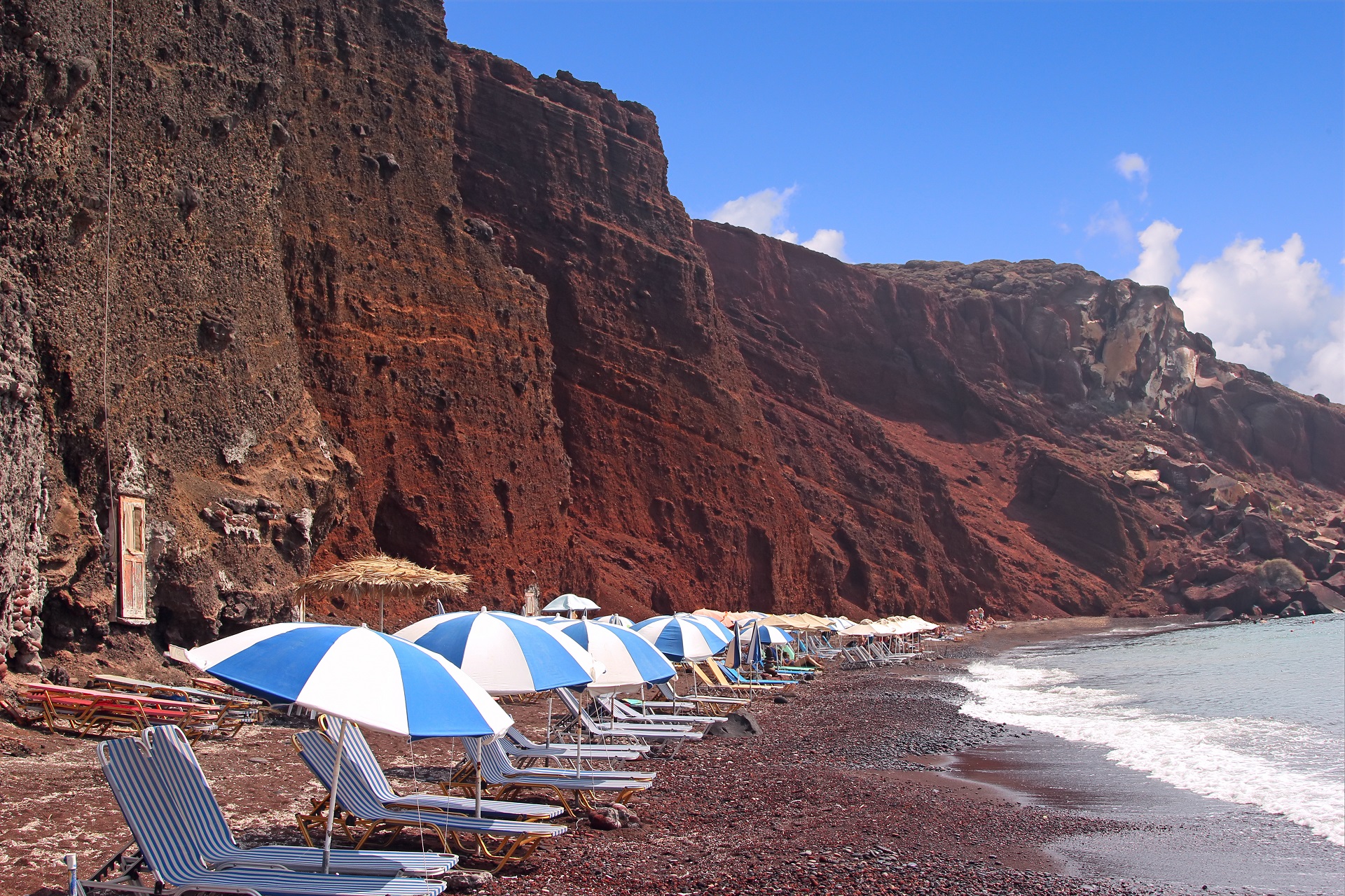
There are plenty of beaches to go around the island. Some of the most famous are Perissa, Kamari, Red Beach, Vlyhada, Plaka, Almira and more.
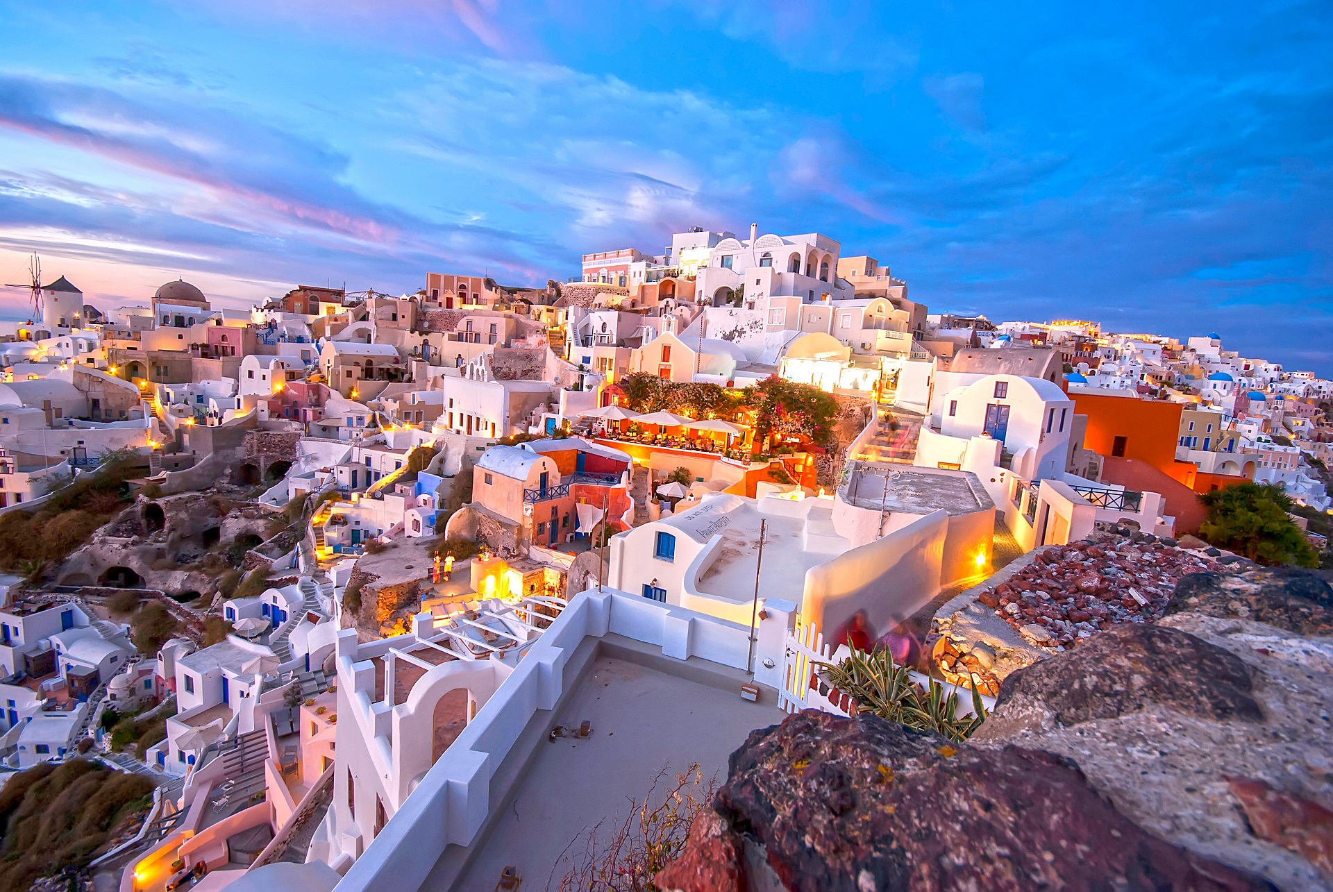
Oia and The Oia Sunset
Santorini is famous for its beautiful sunsets, and the village of Oia is the most popular spot. The village praised for its beauty and charm and can be enjoyed at any point of the day; however, the sunset is its most enchanting feature. It is said that it is one of the most beautiful sunsets on earth. It can only be seen from the tip of the island which means the number of visitors waiting to see this incredible sight can sometimes make it a little hectic.
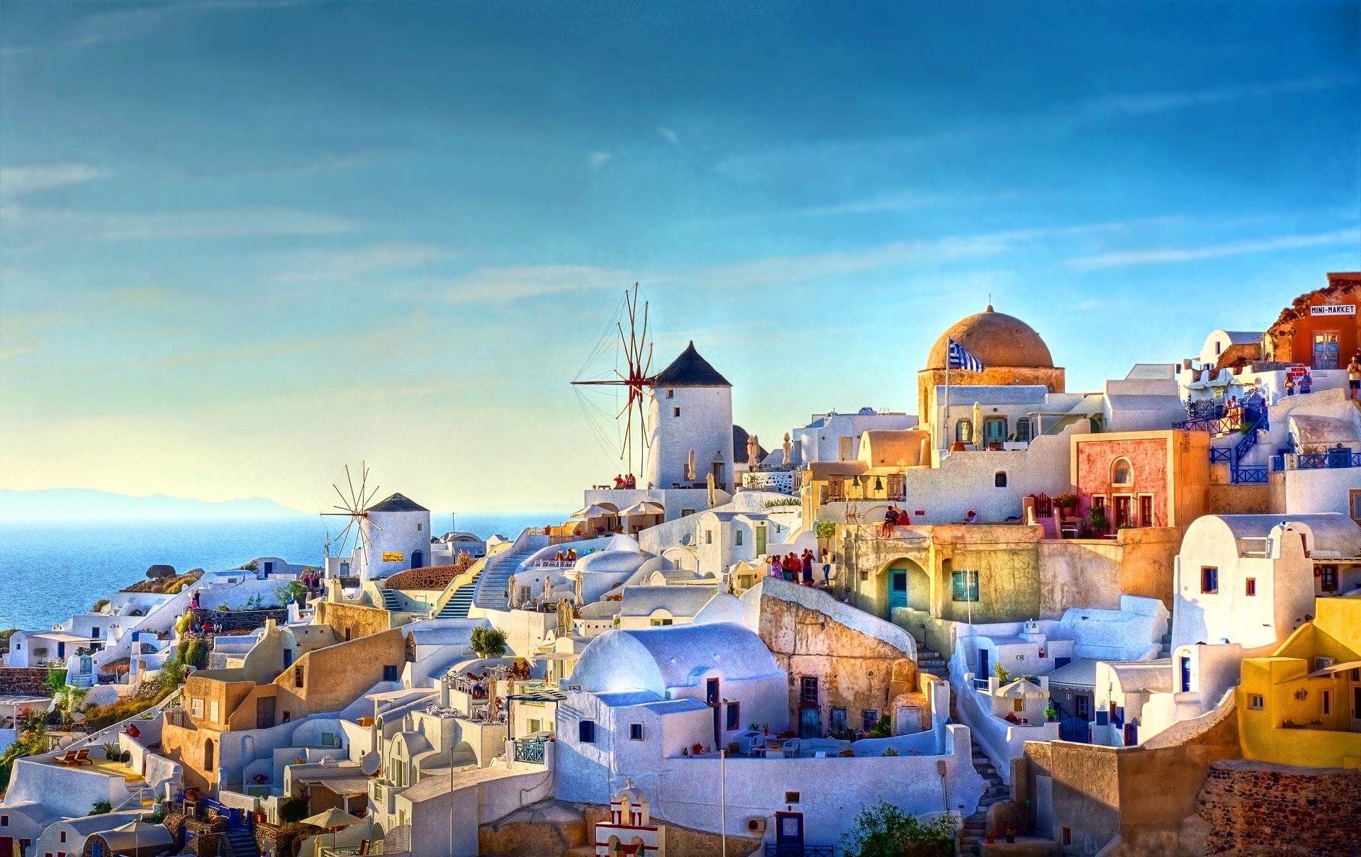
For ages, Oia was called Epano Meria (Upper Side), since it is built on the northern side of the island. It is a significant settlement known all over the world for the magnificent sunset from its Goulas. In recent years the buildings have become hotels, restaurants, cafes, stores.
The settlement is very attractive and therefore from dawn until dusk it is filled with visitors. Nights in Oia remain peaceful, though, and walking in the center marble laid road, loitering the impressive and exquisitely lit buildings is a real pleasure.
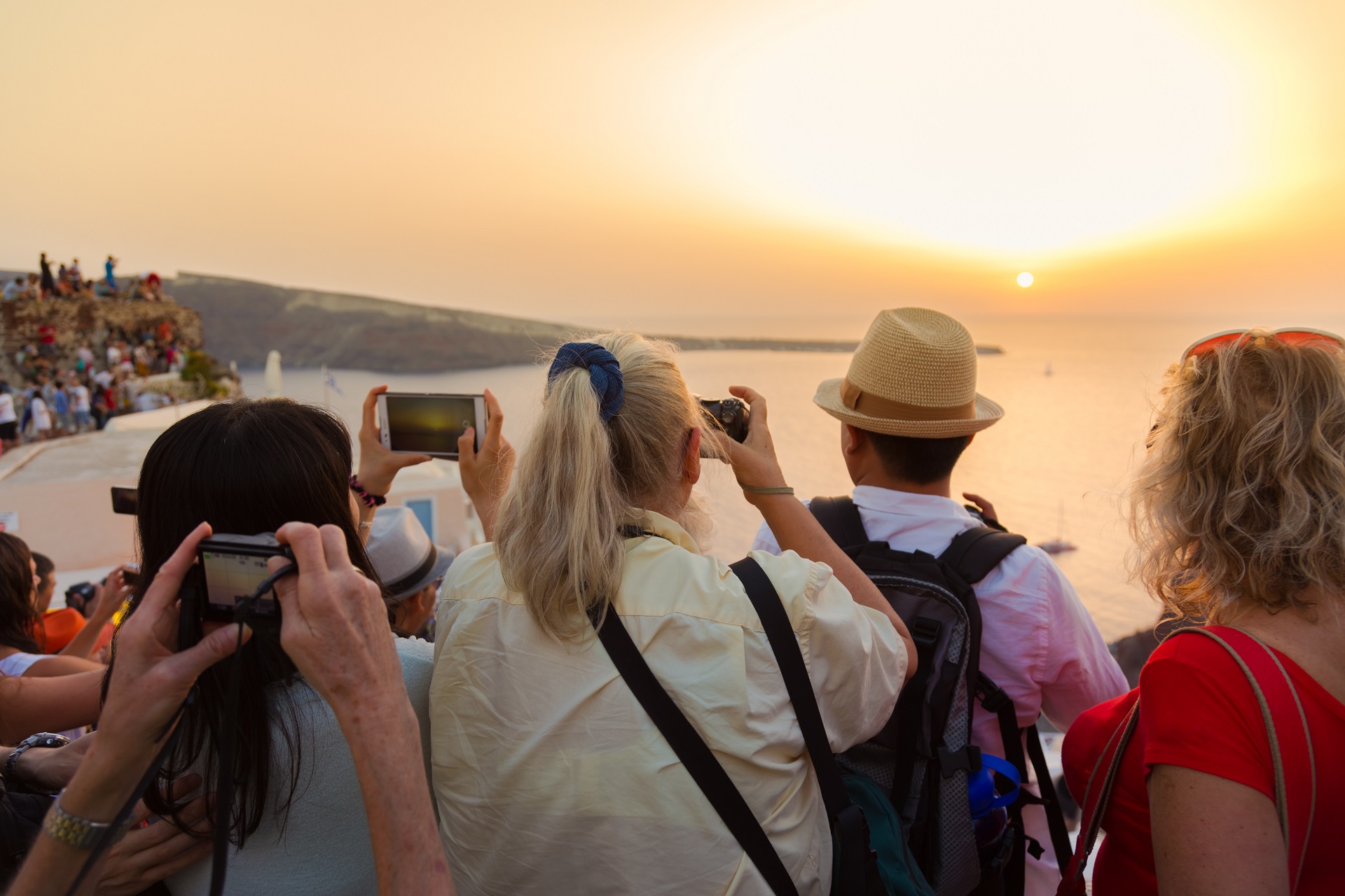
During the sunset, tens of people full of awe from the greatness they face, sit on roofs and balconies silently admiring one of the rarest spectacles on earth.
Carved-in buildings and captains’ houses
Characteristics of the settlement are its carved-in buildings and the so-called captains’ houses (“kapetanospita”) having unique neoclassic elements. As writer Kadio Kolimva from Oia notes: “…carved-in buildings of Oia with stubbornness from the downslope are trying to find a space to exist. Houses without foundations spread out in the light, illuminated early, with nothing to disturb their concatenation of lines and colors. Always at the front, a tiny courtyard with a tiny “alitana,” a flower-bed with fragrant jasmines, honeysuckles, verbenas, and lavenders.”
In 1993, Oia was characterized as a traditional settlement by presidential decree, and the entire island of Santorini as an area of “exceptional natural beauty.”
Oia suffered from the 1956 earthquake. During 1970 through the GNTO pilot program “Development and Utilization of Traditional Settlements,” Oia got its first sewage system, the weaving mill, and the original edifice of the Maritime Museum. Churches, windmills and other buildings were restored. The GNTO project won awards at the 1979 Europa Nostra and the 1986 Sofia Biennale of Architecture, inspiring private initiatives for the restoration of buildings that are now used as hotels, restaurants, shops, cafés, etc.
Oia is now a model community with modern infrastructures. The village’s infrastructure focuses on being both environmentally friendly and at the same time keeping the architecture and aesthetic of the traditional style of the community. There are no aerial power and phone cables, as all cable networks are underground. There is also a seawater desalination plant and units for the biological cleaning of wastewater.